The Impact of Location on Commercial Property Assessment in Dufferin County
Commercial values in Dufferin County rarely swing on a single attribute. Square footage, lease terms, and building condition matter, yet location often calls the tune. Across Orangeville, Shelburne, Grand Valley, and the rural townships, the same 10,000 square foot building can carry materially different numbers on a valuation report depending on what sits outside its doors. Access to Highway 10 or Highway 9, proximity to labour, the quality of municipal servicing, conservation constraints, even modest shifts in traffic patterns along Broadway can push capitalization rates and land values one direction or the other.
That is why commercial property assessment in Dufferin County, whether performed by commercial building appraisers or reviewed by owners for accuracy, needs to read the market at a street level. Mass appraisal models look for averages. Real outcomes follow the ground truth of location.
The geography that shapes value
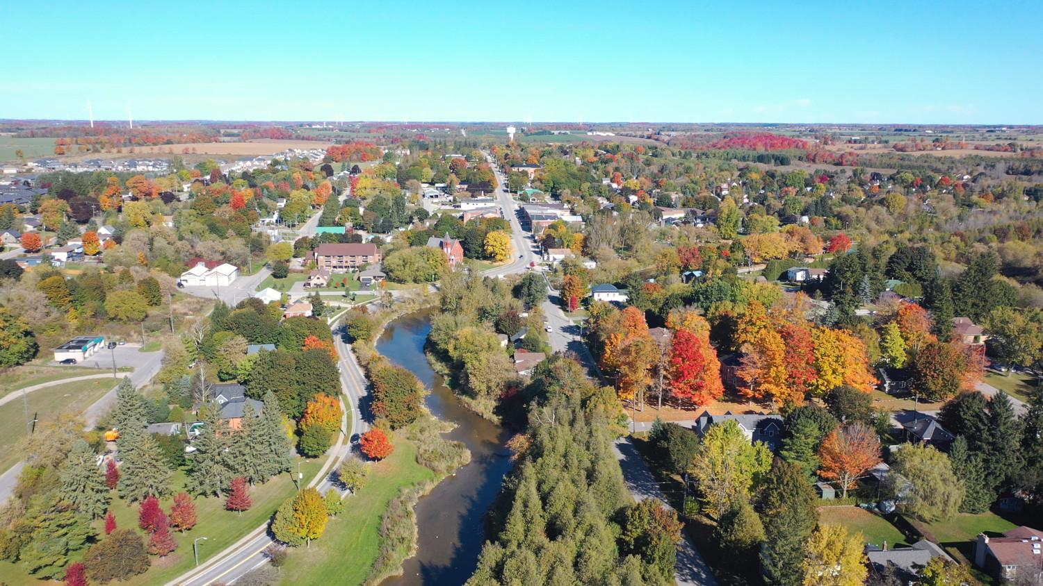
Dufferin’s market is anchored by Orangeville, the employment and retail hub with a mature industrial base along Riddell Road and Centennial Road, and strong retail corridors on Broadway and First Street. Shelburne, to the north on Highway 10 and Highway 89, has seen rapid residential growth over the past decade, which in turn changes retail demand and raises the ceiling for new industrial and service commercial product. Grand Valley sits to the northeast with a smaller commercial footprint and a more local trade area. The rural townships - Mono, Amaranth, East Garafraxa, Mulmur, and Melancthon - add scattered highway commercial nodes, quarry and aggregate operations, farm-related businesses, and destination retail tied to recreation.
Travel corridors do most of the heavy lifting. Highway 10 funnels daily commuters and delivery trucks. Highway 9 links Orangeville to Caledon and the GTA. Highway 89 carries cross-county movement to and from Simcoe and Wellington. Airport Road cuts through Mono and Mulmur and brings weekend recreation traffic. These routes determine visibility, travel times, and logistics costs, all of which work their way into rents and yields.
Conservation and planning overlays influence what can be built or expanded. Portions of the county fall under Niagara Escarpment Commission oversight. Nottawasaga Valley Conservation Authority regulates floodplains and wetlands that cut into developable acreage or force expensive mitigation. Wellhead protection areas add constraints on uses that handle fuels or chemicals. Zoning bylaws vary by municipality and sometimes by corridor. A parcel with the right designation and no encumbrances is a different asset than the same frontage with a floodline, regardless of how it looks from the road.
How location converts into numbers on the report
Commercial building appraisal in Dufferin County relies on the same three approaches seen elsewhere, but location changes the inputs.
Under the income approach, rent comparables, vacancy assumptions, and cap rates depend on trade area strength and tenant demand. A small-bay industrial unit near Riddell Road with 18 foot clear, gas heat, and drive-in loading might rent at a premium to a similar bay in Grand Valley, because Orangeville offers denser customer bases and shorter hauls for suppliers. That can translate into lower vacancy and downticks in the cap rate, pushing value per square foot higher. In Shelburne, cap rates have trended down as the town grew and investors gained comfort with absorption, but they still usually sit higher than Orangeville for similar assets because the depth of tenants is thinner.
In the sales comparison approach, location premiums show up directly in price per square foot and price per acre. Highway frontage and signalized access often command meaningful spreads over mid-block positions. Parcels within a minute or two of Highway 10 or Highway 9 tend to outperform those tucked deeper into industrial parks without through traffic, unless the latter deliver superior specs or expansion potential.
The cost approach, while secondary for income-producing assets, matters for special-use properties and new construction. Here, location plays through land value and https://lanenoub656.theburnward.com/local-expertise-matters-hire-a-commercial-appraiser-in-dufferin-county soft costs tied to servicing. A fully serviced industrial lot in Orangeville will price differently than a partially serviced rural commercial lot on Airport Road requiring private well and septic, stormwater management, and potential road widening conditions. Development charges differ by municipality and add to the all-in cost basis, which rings through the replacement cost new less depreciation calculation.
Orangeville, Shelburne, and the rest: locational nuances that move value
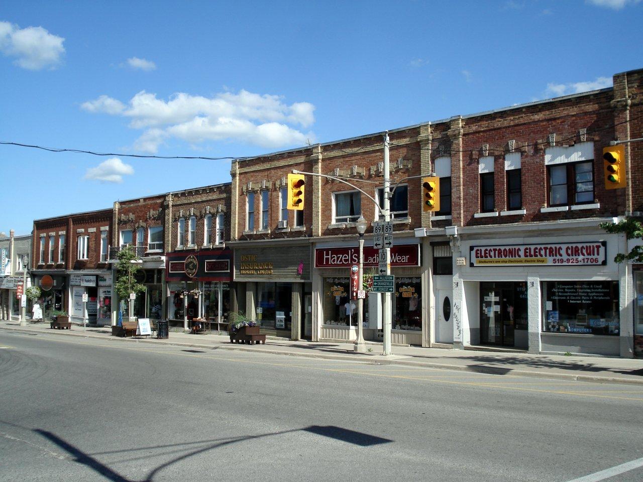
Orangeville behaves like a small regional center. Retail on Broadway benefits from pedestrian traffic, civic uses, and heritage appeal, but parking and loading can be tight, and floor plates are varied. First Street handles more auto-oriented retail and service tenants, with better parking and exposure. Investors in these corridors watch tenant mix closely. National covenants will trade tighter than local independents, and even within nationals, a dollar store pays different rent and attracts a different cap rate than a quick-service restaurant with drive-through. For industrial, the Riddell and Centennial clusters benefit from established logistics patterns, multiple access points, and a skilled local workforce. As a rule of thumb, stabilized small-bay industrial in Orangeville often achieves lower cap rates than comparable product in outlying towns, sometimes by 50 to 100 basis points, assuming similar lease terms and building quality. Ranges still vary with risk, age, and tenant covenant.
Shelburne’s growth story is powerful for retailers. Grocers, pharmacies, and quick-service food along Highway 10 and Highway 89 increasingly pull shoppers who used to drive to Orangeville. That said, daily traffic composition matters. A freestanding drive-through pad at a signal with easy right-in, right-out captures a different spend than a mid-block strip with one entrance near a queueing pinch point. Industrial has momentum but not the same depth. Investor appetite has improved, and commercial appraisal companies in Dufferin County have recorded firmer pricing on serviced lots with credible absorption paths. Still, lease-up assumptions often carry slightly longer exposure times than in Orangeville, which shows up in both pro forma vacancy loss and sensitivity around cap rates.
Grand Valley sees tight supply and local-service retail with modest floor areas. Rents reflect local capture rather than regional pull. A family dental clinic, a veterinary practice, or a convenience store with fuel will sometimes pay market-leading rents relative to other local tenants because of stable demand and limited competition, but investors price liquidity risk into yields. Offices serving agricultural clients, contractors, and home-based entrepreneurs pepper the market. In appraisal terms, one must be careful not to over-index on out-of-town comparables with stronger traffic counts.
The townships present a patchwork. Airport Road carries weekend traffic to ski hills and cottage country, which buoys destination retail, farm-gate operations, and hospitality. Yet zoning and conservation constraints can limit intensification even when demand exists. Highway commercial nodes at rural intersections trade on visibility and parking, not walkability. Build-to-suit users like contractors’ yards find value in larger rural lots with low carrying costs, but those sites rarely draw institutional investors, so exit cap rates widen and appraisal values lean on owner-user benchmarks.
Site exposure, signage, and the micro-location effect
Two properties on the same corridor can diverge in value because of micro-location. Signalized corners at Broadway and First Street post stronger retail performance than mid-block locations that rely on shared driveways. In Shelburne, the difference between being on the approach to the Highway 10 and 89 intersection versus sitting a block back with no pylon sign can be 10 to 20 percent in achievable rent for certain uses. Industrial tenants care less about signage and more about truck movements. A cul-de-sac with tricky turning radii or a low rail crossing nearby can shave real dollars off rent and inflate downtime between tenants.
Parking ratios shape tenant demand. Medical office users usually want 4 to 5 stalls per 1,000 square feet, sometimes higher for clinics with procedure rooms. Main-street buildings with 2 to 3 stalls per 1,000 and municipal lots nearby can work for general office and boutique retail, but not for high-turnover medical or fitness users. When parking underperforms tenant requirements, owners compensate with lower base rent or increased tenant improvement allowances, both of which reduce net operating income and assessed value.
Servicing and entitlement carry weight
The presence of municipal water and sanitary sewer service, adequate fire flows, and stormwater capacity differentiates properties. Orangeville’s serviced employment lands typically support higher site coverage and faster approvals than rural sites on well and septic. In Shelburne, the serviceability status of a parcel can swing land value by six figures per acre. Appraisers see this in the land residual: if you need to set aside more acreage for private septic or storm ponds, your buildable area declines and the pro forma tightens.
Entitlements also change value in real time. A parcel zoned Highway Commercial with site plan approval for a two-tenant pad, drive-through confirmed, and no outstanding conservation issues is a different thing than a similarly designated parcel awaiting traffic impact studies, MTO permits, and NVCA clearances. Commercial land appraisers in Dufferin County will calibrate the discount for entitlement risk based on the stage of approvals, consultant reports in hand, and local precedent.
Environmental overlays and development risk
Floodplain mapping in parts of Orangeville and Mono can sterilize ground-floor retail space or require raised finished floor elevations that complicate accessibility and loading. Properties under Niagara Escarpment Commission jurisdiction face added review layers, particularly for expansions or signage. Wellhead protection areas impose risk management plans for uses that store or handle specific materials. None of these automatically kill value, but each adds friction, time, and cost, which investors convert into higher yields or lower land bids.
For quarry-adjacent sites, market perception sometimes depresses office or retail value even in the absence of measurable nuisance. Appraisers will look for paired sales or rent differentials to support any adjustment rather than applying a blanket stigma. Wind farm proximity in Melancthon rarely affects commercial uses directly, yet it can influence public sentiment or municipal policy during rezoning, which matters for speculative land buyers.
Labour, logistics, and the daily math of tenancy
Employers prize reliable labour pools. Orangeville and Shelburne both draw from growing populations, with commuting links to Caledon and Brampton. For industrial and service users, 15 to 30 minute drive-time maps often determine which side of the county they choose. A firm that needs early morning shifts may avoid a location that requires staff to cross congested intersections without transit options. Even without formal transit service, walkability and cycling infrastructure around Broadway helps certain employers recruit, which filters into lower turnover and stronger tenant stability.
Logistics cost cuts two ways. A distributor serving Caledon and the 410 corridor may prefer a Caledon site over Orangeville, but a local contractor serving Dufferin will find Orangeville or Shelburne more efficient. Inventory turns, fuel costs, and driver availability translate into what a tenant can afford to pay per square foot. That is why industrial rents in Dufferin often sit at a discount to GTA West nodes, while still offering healthy returns for landlords who bought land at county prices.
Retail clustering and tenant mix
Clusters attract clusters. Restaurants near cineplexes or community centers enjoy evening and weekend spikes that isolated pads cannot replicate. Health care providers often group around medical clinics or hospitals to share referrals and convenience. In Orangeville, proximity to Headwaters Health Care Centre aids medical office absorption, while in Shelburne, clinics near the core or along Highway 10 capture drive-by patients and new residents. Where clustering is present, landlords can push for percentage rent structures in food and beverage, or at least hold firmer on rent escalations. Absence of clustering, or an unbalanced tenant mix, supports more conservative underwriting.
What commercial property assessment, mass appraisal, and appeals get right and wrong
In Ontario, property assessment for taxation is produced by the Municipal Property Assessment Corporation using a current value approach supported by mass appraisal techniques. For commercial assets, MPAC relies on rent, expenses, vacancy, and cap rate models anchored to a legislated valuation date. The cycle and the valuation date are set by the province, and updates have periodically been deferred, which means the assessed value can lag market movement. That does not absolve owners of taxes, but it creates room to challenge assessed values when property-specific facts undermine the model’s assumptions.
Mass appraisal tends to smooth out neighbourhood differences. It can underweight a corner’s premium or fail to capture the drag from limited access or unusual parking constraints. It often assigns generic cap rates by use type and municipality. When the model lumps a high-exposure Broadway storefront with a mid-block unit in a mixed-use building on a side street, the result can misstate current value. Conversely, for industrial, where comps are plentiful in core parks, MPAC’s values can be close, and the room to move in an appeal narrows.
Commercial building appraisers in Dufferin County who prepare fee simple valuations for financing or acquisition will go deeper on micro-locations, tenant stability, and lease terms. They audit the actual rent roll, review clauses like termination options and co-tenancy, and measure recoveries against actual expenses. They also match cap rates to risk with an eye for liquidity, lease rollover, and property-specific issues like deferred maintenance or specialized improvements with limited reuse. That level of granularity is how location migrates from a slogan to a supportable number.
Asset type specifics: where location weighs heaviest
Retail depends on traffic, access, and competition. A net-leased bank branch at a prime Orangeville corner with long remaining term and rental escalations will trade at a sharp cap compared to a convenience strip on a secondary road with month-to-month tenancies. Even within Orangeville, the leap from Broadway’s core blocks to outer segments can change the rent curve. In Shelburne, new plazas capture growth, but the difference between a full movement intersection and a single right-in, right-out with stacking constraints for a drive-through can add or subtract seven figures from value upon stabilization.
Industrial rewards functional, efficient sites with highway proximity. Ceiling height, loading, and yard area shine, yet the right location lowers total occupancy cost for tenants by cutting travel time. For Orangeville and Shelburne, that often means quick access to Highway 10 and minimal truck conflict with retail corridors. Rural industrial on larger lots suits contractors, landscape suppliers, and storage users. Those tenants pay less rent but accept basic specs. As yields compress in the GTA, investors sometimes chase return in Dufferin’s industrial. The cap rate gap has narrowed in recent years, in some cases to within 75 to 150 basis points of comparable GTA secondary nodes, but spreads widen again for single-tenant buildings with near-term rollover in less central locations.
Office is thin outside of medical and government in Dufferin. Location near hospitals, municipal facilities, and arterial roads helps. Downtown Orangeville offers character space that some professional users value, although accessibility and parking can strain. Class B suburban offices along First Street or Broadway can deliver steadier parking and simpler layouts. In appraisal terms, leases for small suites often trend gross or semi-gross, and expense recoveries vary widely, so location-driven vacancy and inducement expectations need careful calibration.
Hospitality and auto-centric uses lean on corridor exposure. Highway frontage, signage height, and turning movements make or break performance. Properties with historic motel layouts on older alignments can struggle if new alignments redirect traffic. Gas bars and c-stores on corners with queueing room and stacking for pumps price ahead of sites where cars back onto the highway shoulder. These are small differences that compound through volume.
Land values and the entitlement premium
Commercial land in Dufferin prices on three variables: the corridor, the ability to service, and the certainty of approvals. An acre on Highway 10 with full services adjacent to recent development and no conservation encumbrances can trade at a multiple of a similar acre on a tertiary road with partial services and a need for studies. Commercial land appraisers in Dufferin County usually stratify comparables by stage of readiness. Raw designated land sells at one number, draft plan or site plan approved land at another, and shovel ready pads at a third. The spread reflects risk, carrying time, and soft costs already sunk.
In Orangeville, serviced industrial land near Riddell or Centennial commands a premium because buildable coverage is higher and time to market is shorter. In Shelburne, industrial land values have climbed with population growth, but overhang from servicing constraints or off-site upgrades can hold some parcels back until municipalities complete infrastructure. Buyers discount those timelines, which is precisely how location - in the sense of what lies under the ground and which approvals remain - turns into dollars.
Practical ways owners can show location accurately in an assessment or appraisal
Location is a story best told with evidence. Owners who organize that evidence see stronger outcomes in both financing appraisals and tax assessment reviews.
- Map your catchment: drive-time maps for staff and customers, traffic counts for your frontage, and any new generators like grocery stores or subdivisions that shift patterns.
- Document access: photos and plans showing turning movements, signalization, shared driveways, and queueing capacity for drive-through or loading.
- Prove tenant demand: summarize lease-up history, inquiries received, and waitlists for comparable space, especially in tight submarkets.
- Quantify constraints: compile NVCA or NEC correspondence, wellhead protection maps, and any easements that reduce developable area.
- Benchmark rents and yields: maintain a file of recent leases and sales within the same corridor or node, not just the same municipality.
These materials let a commercial building appraisal in Dufferin County capture the right assumptions on vacancy, net rents, and cap rates. They also form the backbone of a reasoned response if a mass appraisal model paints too broad a stroke.
How we reconcile cap rates with small market reality
Investors in Dufferin tend to be local or regional, with a growing number of private buyers from the GTA. For stabilized multi-tenant retail in prime Orangeville locations with national tenants and solid parking, cap rates often cluster in the mid to high 5s to low 6s depending on term and rent step-ups. Secondary retail or strips with local tenants may sit in the mid 6s to 8s. Small-bay industrial with good specs in Orangeville can see cap rates in the high 5s to mid 6s when leased to multiple tenants. Single-tenant buildings or rural industrial with specialized improvements will trend higher, sometimes into the 7s or 8s, reflecting rollover risk and narrower buyer pools. In Shelburne, as the market deepens, the best assets narrow the gap to Orangeville, while tertiary locations remain wider.
These are ranges, not promises. The exact number follows lease term, covenant strength, building age, required capital, and micro-location. A building next to a future intersection improvement or a planned subdivision may merit a tighter yield because the trade area strengthens over the hold period. A site with limited left turns or constrained truck access pushes the other way. Experienced commercial appraisal companies in Dufferin County will triangulate cap rates from sales, lender guidance, and investor interviews, then adjust for the subject’s specific location factors.
When to call a specialist and what to ask
Location complexity grows with constraints and tenant mix. If your property sits near a floodplain boundary, relies on drive-through volume, or has a specialized industrial use, a generalist may miss important adjustments. Commercial building appraisers in Dufferin County who work the Orangeville and Shelburne corridors weekly build a deeper file of paired data points that improves confidence in the final opinion of value. For commercial land, a local appraiser who understands servicing timelines and precedent approvals under the local conservation authority helps avoid both overvaluation and needless discounting.
If you are interviewing firms, ask how they adjust for micro-location within the same street, what cap rate spreads they see between tenancy types within the same node, and how they treat environmental overlays in highest and best use. Request anonymized examples where location drove a material adjustment, and how they supported it with evidence. That is where the difference lies.
Preparing for a review or appeal without wasting a season
Ontario’s assessment system offers avenues to request reconsideration and, if necessary, to appeal. Owners who prepare tight, location-driven files manage the process efficiently.
- Frame the issue: specify the micro-location factor the model missed, such as restricted access or an uncorrected floodline.
- Lead with market evidence: present corridor-specific rents, sales, and cap rates, not generic municipal averages.
- Tie facts to value: quantify how the constraint changes net operating income or investor yield.
- Use maps wisely: include annotated aerials showing driveways, signals, and competing nodes within the true trade area.
- Be timely: track deadlines and align submissions with the legislated valuation date used for the assessment.
This is not about arguing that taxes are high. It is about matching the property’s real location to market outcomes that can be measured.
A closing perspective from the field
Dufferin County punches above its weight because it sits close enough to the GTA to borrow demand and far enough to offer value. Within that frame, location remains the arbiter. A pad at a signal on Highway 10 in Shelburne with clean turning movements holds a different cap rate than a similarly sized pad two driveways down with no stacking room. An industrial bay off Centennial with a simple truck loop rents better than a similar bay on a cul-de-sac with tight corners. A main street unit two doors from a public parking lot in Orangeville has a different rhythm than a unit halfway down the block fronting a narrow sidewalk.
Every appraisal and every assessment should reflect those facts. When owners, brokers, and appraisers treat location as a set of measurable advantages and constraints rather than a slogan, numbers fall into place. For commercial property assessment in Dufferin County, that is the work: translating corridors and corners, signals and sightlines, overlays and approvals into rents, vacancies, and yields that stand up to scrutiny.